On 29 May 2006, a mud eruption in East Java in Indonesia burst through the ground. It spewed enough hot, steaming mud to eventually cover about 7 square kilometers of land, forcing almost 60,000 people to abandon their villages. And it is still erupting. The Lusi mudflow continues to release 80,000 cubic meters of mud per day.
Since 2006, intensive research has revealed key geological insights into the eruption, but many questions (including whether drilling or an earthquake triggered it) remain. A new study by Fallahi et al. provides a fresh perspective, revealing connections between the plumbing of the Lusi mudflow and that of nearby magmatic volcanoes.
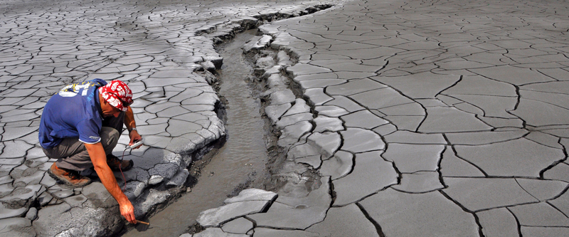
 A scientist on a freshly dried mud flow examines one of the streams flushing water and mud spewed by the geysering Lusi vent site. Steam from Lusi can be seen in the background. Credit: LUSI LAB project
The new findings arose from previous research indicating the potential importance of the Watukosek fault system, which runs between Lusi and a volcanic system known as Arjuno-Welirang. Lusi is located in a back-arc basin, in the overriding plate of a subduction zone but behind the main volcanic arc where Arjuno-Welirang lies.
Investigating this linkage should have been straightforward. Geologists have long measured changes in the velocity of seismic waves passing through an area to reveal its geological structure. However, a lack of wave-generating earthquakes near Lusi meant that the researchers could not rely on traditional seismic tomography to answer their questions.
Instead, thanks to recent technological advances, the researchers were able to monitor ambient seismic waves, which are generated continuously by ocean waves. They used a network of 31 seismometers to record ambient seismic waves in the region over a period of 10 months.
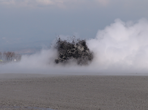
 The Lusi eruption spewed boiling mud tens of meters high during one of the active geysering phases in September 2006. Credit: LUSI LAB project
The correlations obtained from the ambient seismic data allowed the researchers to construct a 3-D model of the region’s subsurface features. Their analysis revealed a hot plume of hydrothermal fluids that extends from the surface of the Lusi crater to a depth of at least 6 kilometers. This plume is connected to Arjuno-Welirang by an elongated feature matching the direction of the Watukosek fault system. Chambers of magma lie beneath active Arjuno-Welirang volcanoes.
These findings suggest that magma, hydrothermal fluids, and other fluids may flow along paths of weakened rock in the Watukosek fault system from the volcanic arc to the back-arc basin deep below Lusi. There the hot fluids encounter sediments rich in organic materials and “bake” them in thermometamorphic reactions that generate enough upward pressure to fuel the ongoing mud eruption.
These findings provide a new perspective on the processes that may feed Lusi and other similar hybrid mud eruptions around the world. (Journal of Geophysical Research: Solid Earth, https://doi.org/10.1002/2017JB014592, 2017)
—Sarah Stanley, Freelance Writer
from Eos https://eos.org/research-spotlights/what-feeds-indonesias-destructive-mud-eruption?utm_source=rss&utm_medium=rss&utm_content=what-feeds-indonesias-destructive-mud-eruption
via IFTTT
